Site hosted by Angelfire.com: Build your free website today!
<\/body><\/html>') newWindow.resizeBy(picWidth-newWindow.document.body.clientWidth,picHeight-newWindow.document.body.clientHeight) newWindow.focus() } //-->
HUGEfloods.com Home Page Not much time? ... Click here for a quick Ice Age Floods summary Ice Age Floods Feature of the month For many years one man understood the clues but no one would listen Glacial Lake Missoula Channeled Scablands of Eastern Washington Temporary Lake Lewis Columbia Gorge Explore the variety of features created by the Ice Age Floods Columbia River Basalt Group The Pleistocene Grand Coulee Dam and the Columbia Basin Irrigation Project Washington Wines Ice Age Floods Institute

Interview: Vic Baker

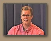
Vic Baker, a University of Arizona geology professor, has been a leader in Ice Age Floods research for over four decades.


Nick Zentner interviews Ice Age Floods expert Vic Baker.

-Click to play then click "HD" on or off depending on connection speed.-
Dry Falls State Park vista.
Dry Falls


Mariner 9 launch, NASA Image.

Launch of Mariner 9
NASA Image


In an interview recorded on June 3, 2011 at Central Washington University, Dr. Vic Baker visits Ellensburg to reflect on his distinguished Ice Age Floods research career. Initially turned on to the Ice Age Floods story when visiting Dry Falls and Sun Lakes State Park as a youth in the 1950’s, Vic returned to Washington’s Channeled Scablands as a University of Colorado graduate student to study the floods formally.

As a PhD student in the 1960’s, Vic received encouragement and support from pioneer floods geologist J Harlen Bretz – and began building on the basic flood story that Bretz first established back in the 1920’s. Baker’s research – with an emphasis on the physics, mechanics, and hydraulics of the floodwater – has greatly improved our understanding of the timing, scale, and effects of the Ice Age flooding of eastern Washington. Late in life, Bretz was keenly interested in Baker’s results, and was delighted to see evidence of huge floods on Mars – first documented by Mariner 9 in the 1970’s.

Later in the interview, Vic discusses the impact of the Ice Age Floods Institute – a nonprofit, grassroots organization devoted to bringing the floods story to residents of the Pacific Northwest. The Institute’s evening lectures and field trips are popular, and Vic comments on why this topic resonates with so many local folks. Outreach to nonscientists is important to Vic - he has appeared on many television documentaries, including being the featured geologist in the NOVA program “Mystery of the Megaflood”.

Late in the interview, Dr. Baker demonstrates how field geologists apply multiple working hypotheses to field questions like, “Did this big flood erratic get carried by an iceberg on the floods – or by the flood water itself?” Finally, he offers suggestions for future work in the Channeled Scablands – and beyond.


- Dr. Baker's Research -

University of Arizona

Lunar and Planetary Laboratory

Geologist Vic Baker on the trail to the White Bluffs rhythmites - Bjornstad photo.
Renowned geologist Vic Baker on the trail to the White Bluffs Rhythmites. [Bruce Bjornstad photo]
Ice Age Flood Institute members enjoy scabland hike.
Hikers explore Ice Age Flood features in Cheney-Palouse scabland tract.
J Harlen Bretz and Vic Baker - Photo by Rhoda Bretz Riley.

2011 Ice Age Floods Field Work

How long have these deposits been at this location? - Samples obtained from flood boulders on West Bar for cosmogenic-exposure age dating.

Hiker stands on top of Giant Current Ripple, created by the Ice Age Floods.
Arrow points to hiker standing on one of the largest West Bar ripples. Babcock Bench in the distance.
Geologist Vic Baker explores Ice Age Floods features on West Bar.
Geologist Vic Baker surveys West Bar flood deposits. [Bjornstad photo]
BLM geologist and Wentachee Ice Age Floods Institute President Brent Cunderla and Vic Baker on West Bar.
Wenatchee Ice Age Floods Institute Chapter President Brent Cunderla [BLM Geologist] - talks with Baker on West Bar. [Bjornstad photo]

Surface Exposure Dating

Surface exposure dating is often used to date glacial advances and retreats, erosion history, lava flows, meteorite impacts, rock slides, fault scarps, and other geological events. It is most useful for rocks which have been exposed for between 10 and 30,000,000 years ... by measuring the concentration of cosmogenic nuclides in a rock sample, and accounting for the flux of the cosmic rays and the half-life of the nuclide, it is possible to estimate how long the sample has been exposed to the cosmic rays. -Wikipedia


Geologist Vic Baker collects small sample of material from Ice Age Floods erratic boulder. .
Baker collects sample. [Bjornstad photo]


Geologist Vic Baker collects small sample of material from Ice Age Floods erratic boulder. .

Sunset view - West Bar Giant Current Ripples from Babcock Bench. Columbia River boat for scale.
- Ripples average 24 feet in height - 360 feet apart -

FREE full length geology programming -

View more "Central Rocks" episodes related to the Ice Age Floods:

Taped on the campus of Central Washington University and hosted by CWU Geology Professor Nick Zentner, 'Central Rocks' is a series of interviews with geologists who teach or conduct research in Washington. 'Central Rocks: Roadside Geology', a new spin-off project, is a series of short films that feature familiar locations along Washington's scenic highways.

Geologist Jim O'Connor - Click to open video link.
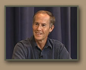
Jim O'Connor

USGS Hydrologist Jim O'Connor discusses current research on Washington's Missoula Floods and Idaho's Bonneville Flood.
Geologist Gene Kiver - Click to open video link.
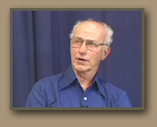
Gene Kiver

EWU Geology Professor Gene Kiver discusses the origins of the Ice Age Floods Institute.
Geologist Bruce Bjornstad - Click to open video link.
Bruce Bjornstad

PNNL Geologist Bruce Bjornstad discusses the Missoula Floods and his popular 'On the Trail of the Ice Age Floods' guidebook series.
Geologist Nick Zentner - Click to open video link.
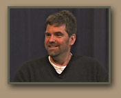
Nick Zentner

CWU Geology Professor Nick Zentner lectures on eastern Washington's unique landscapes (Floods of lava and floods of water).
All photos by Tom Foster unless otherwise noted.
Screenshots courtesy "Central Rocks"

HOME Space CONTACT Space SITE MAP IAFI Space LINKS Space © 2008
Ellensburg
Lake Missoula
Lake Lewis
Ice Age Blog
Ice Age Express
Feature of the Month
The Mystery
25 Features
Channeled Scablands
Ice Age Floods Videos
Columbia Gorge
Feature Types
Columbia River Basalt
The Pleistocene
Grand Coulee Project
Washington Wine
Ice Age Floods Inst.
The Bonneville Flood